
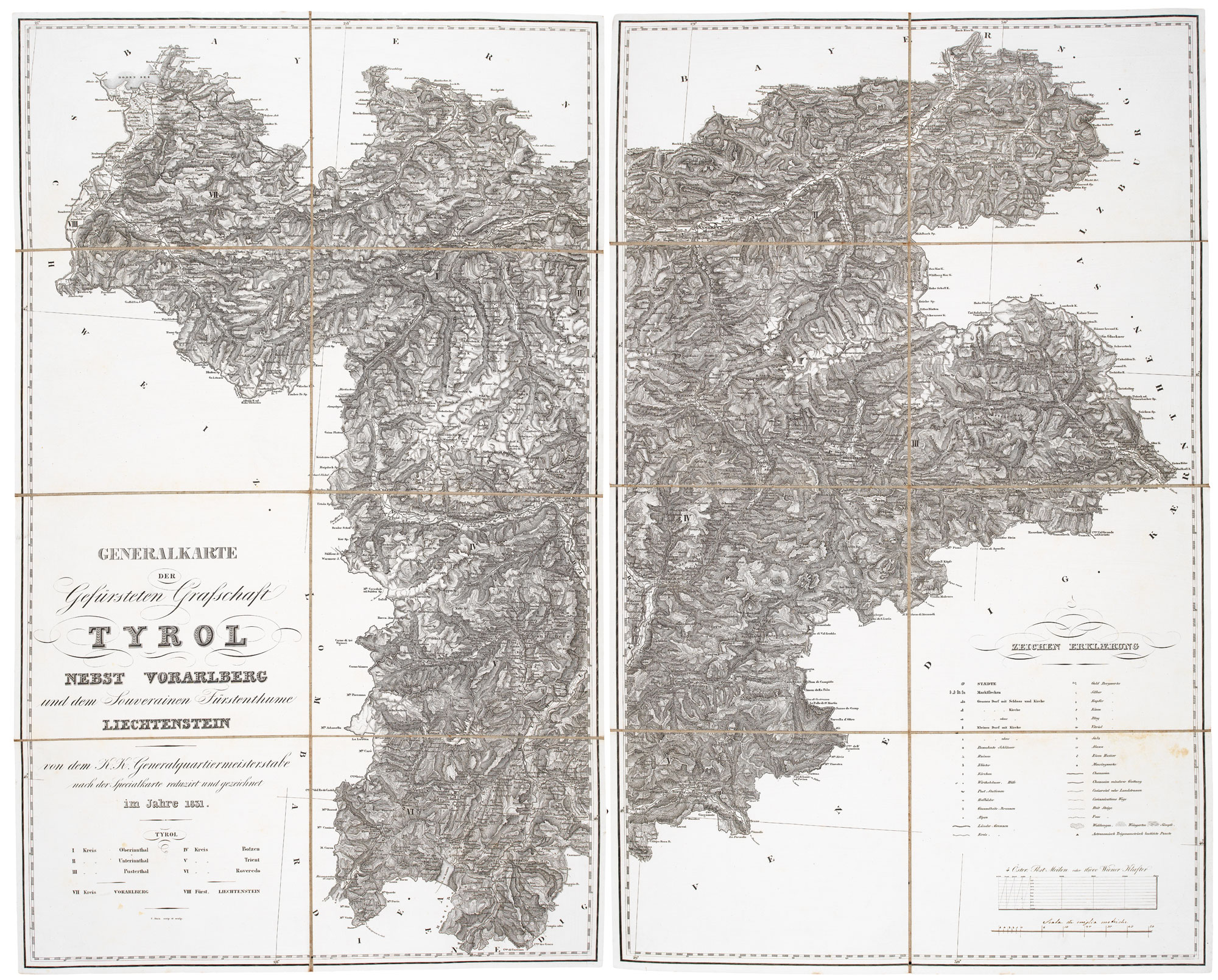
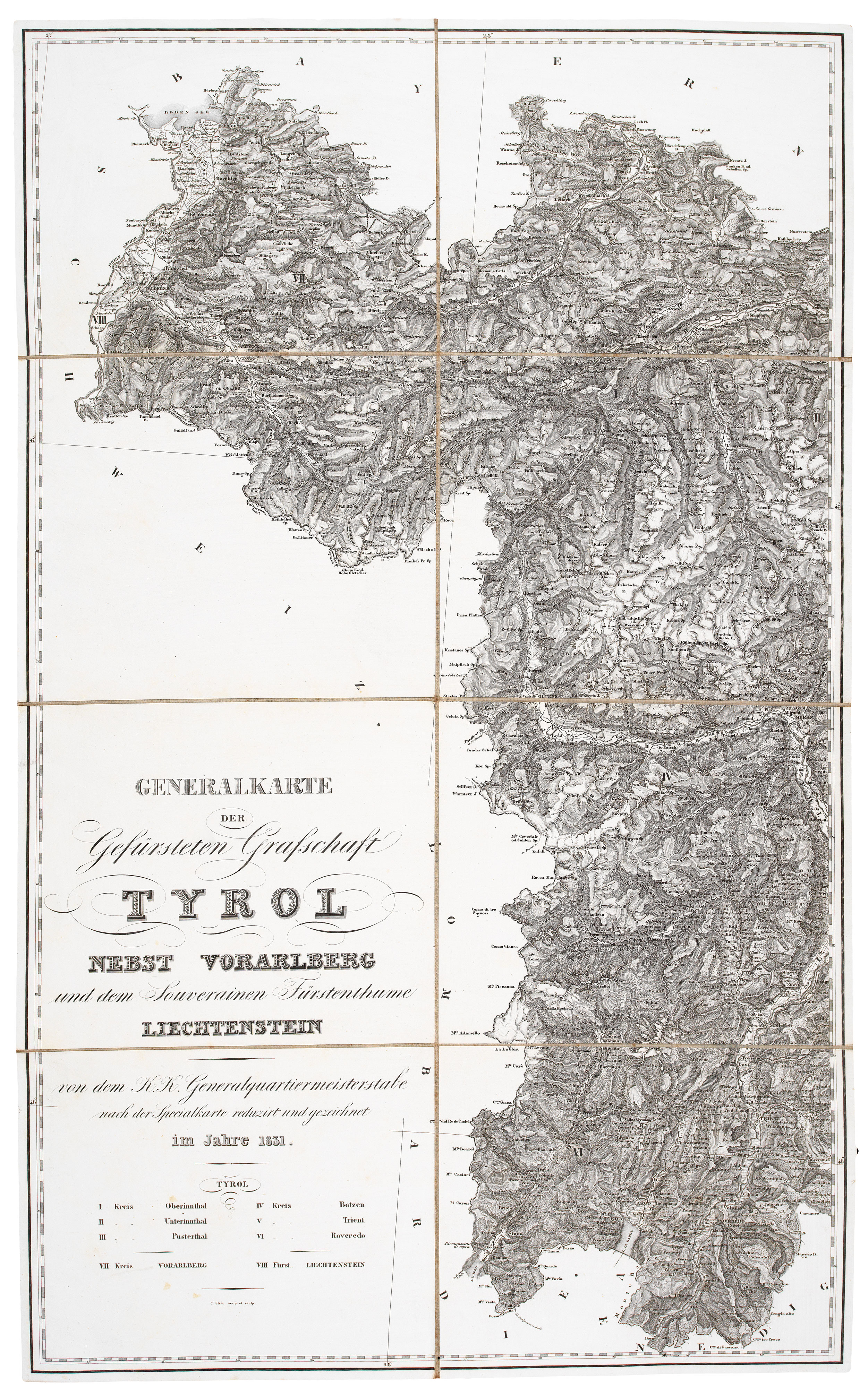
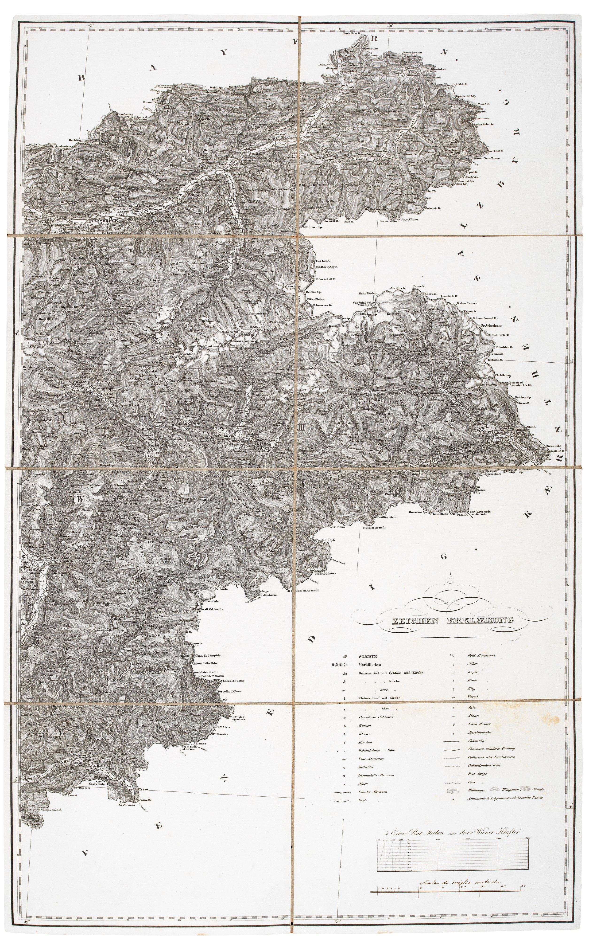
A detailed map of Tyrol, Vorarlberg and Liechtenstein
STEIN, C.
Generalkarte der Gefürsteten Grafschaft Tyrol nebst Vorarlberg und dem Souverainen Fürstenthume Liechtenstein von dem K.K. Generalquartiermeisterstab nach der Specialkarte reduzirt und gezeichnet im Jahre 1831.
Vienna: K. K. Generalquartiermeisterstab 1831. Dissected and laid on linen in two sections, total 790 x 950, with marbled chemise.
Minor foxing to the bottom right, otherwise a fine example.
A large and detailed map of southern Austria and Liechtenstein, engraved by Stein, hachured to show relief. It is reduced from a 23-sheet map by the military surveyors of the Austrian Army, the first trigonometrical survey of the area, published 1823.
Stock ID : 20641
£450
£450


Altea Antique Maps & Charts
Altea Gallery Ltd, 35 St George Street
London
W1S 2FN
United Kingdom
Tel: +44 20 7491 0010
info@alteagallery.com
Sitemap :

