
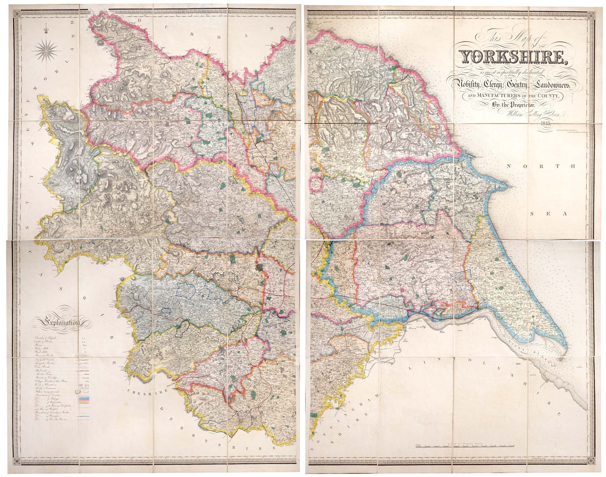
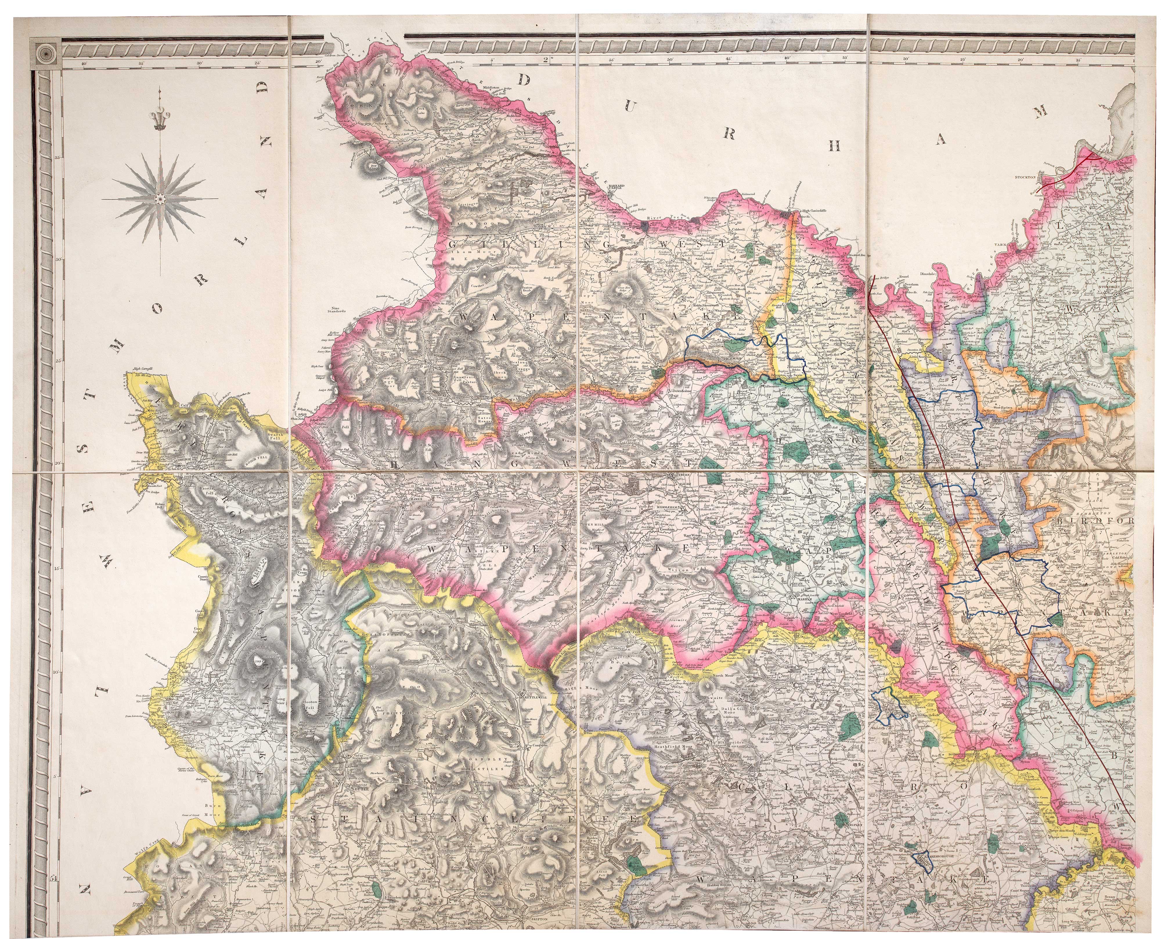
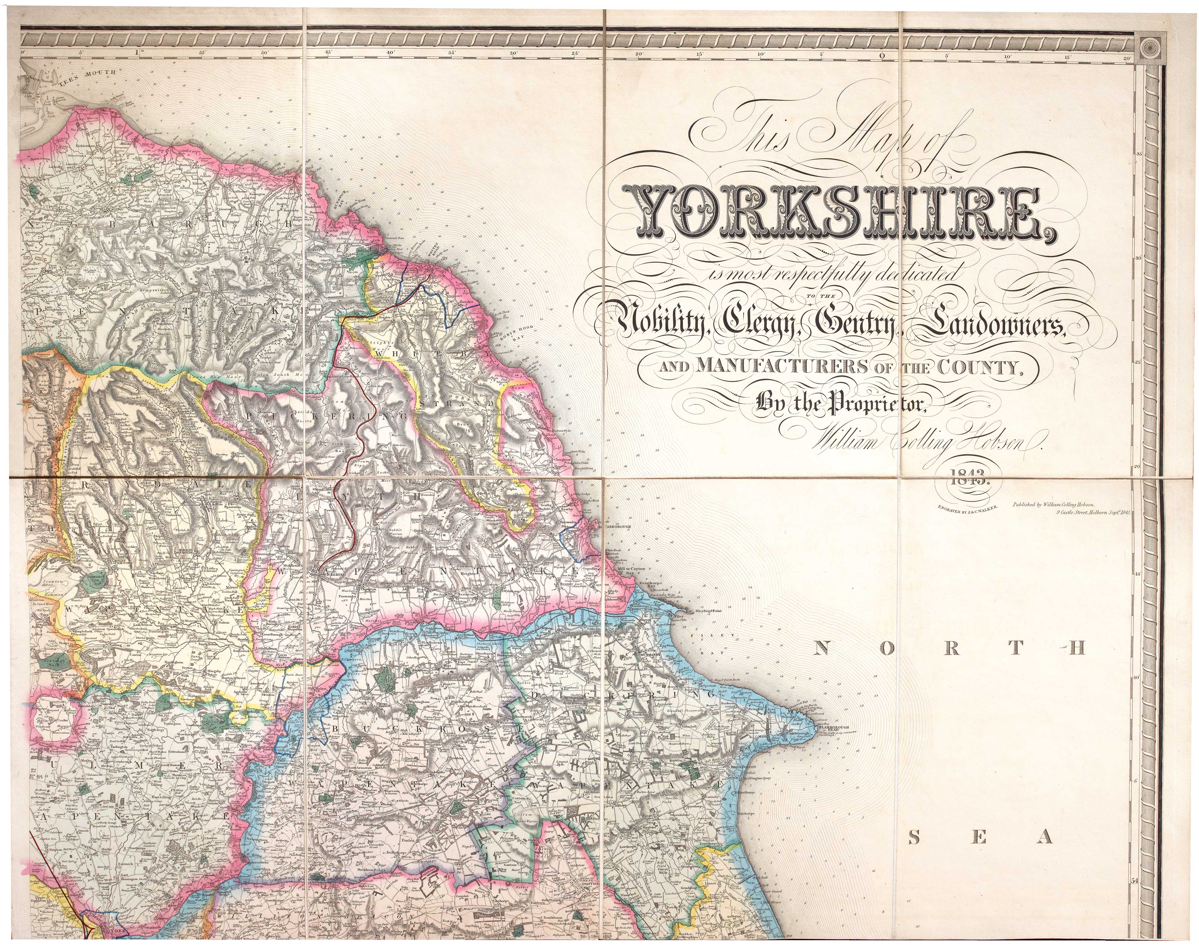
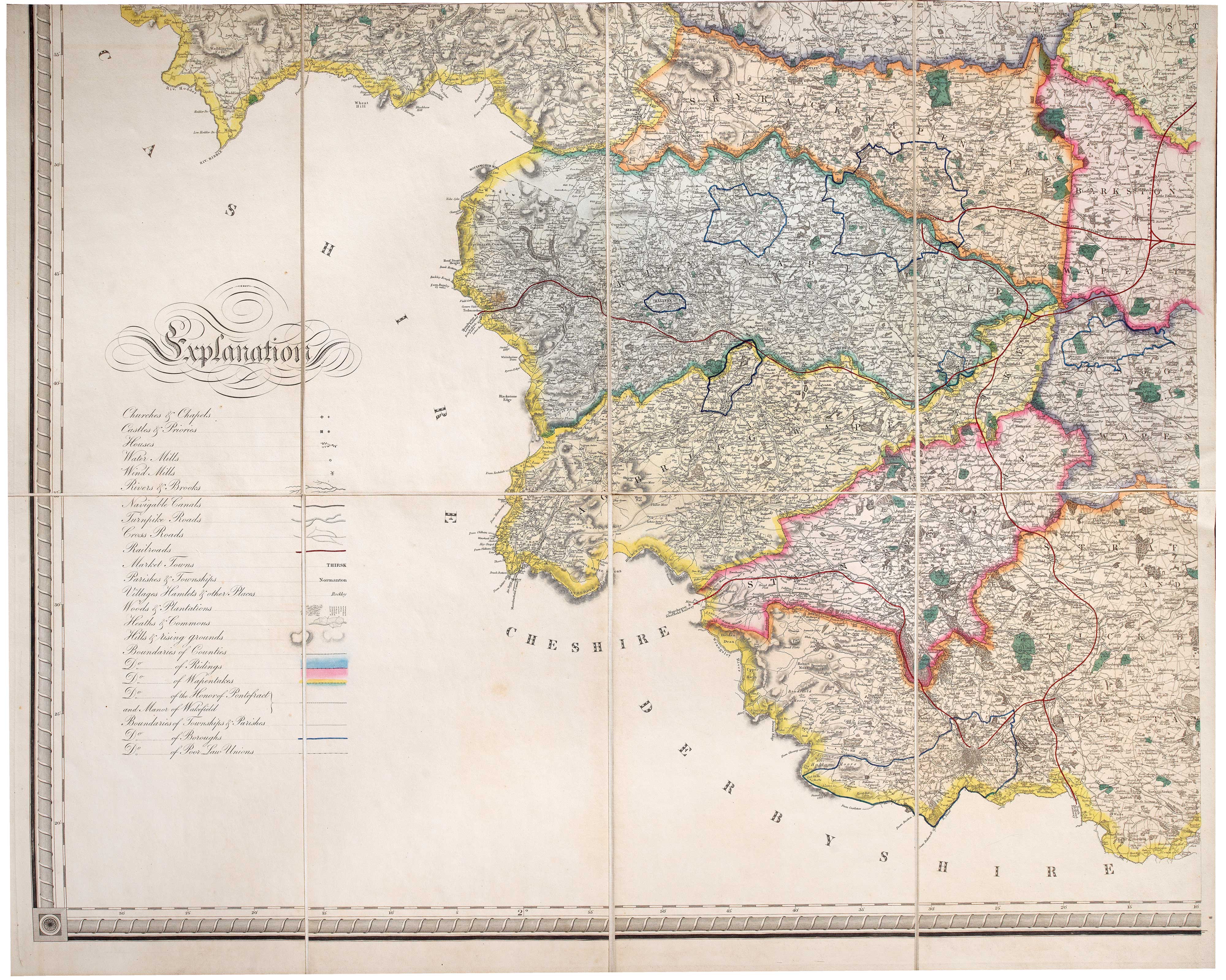
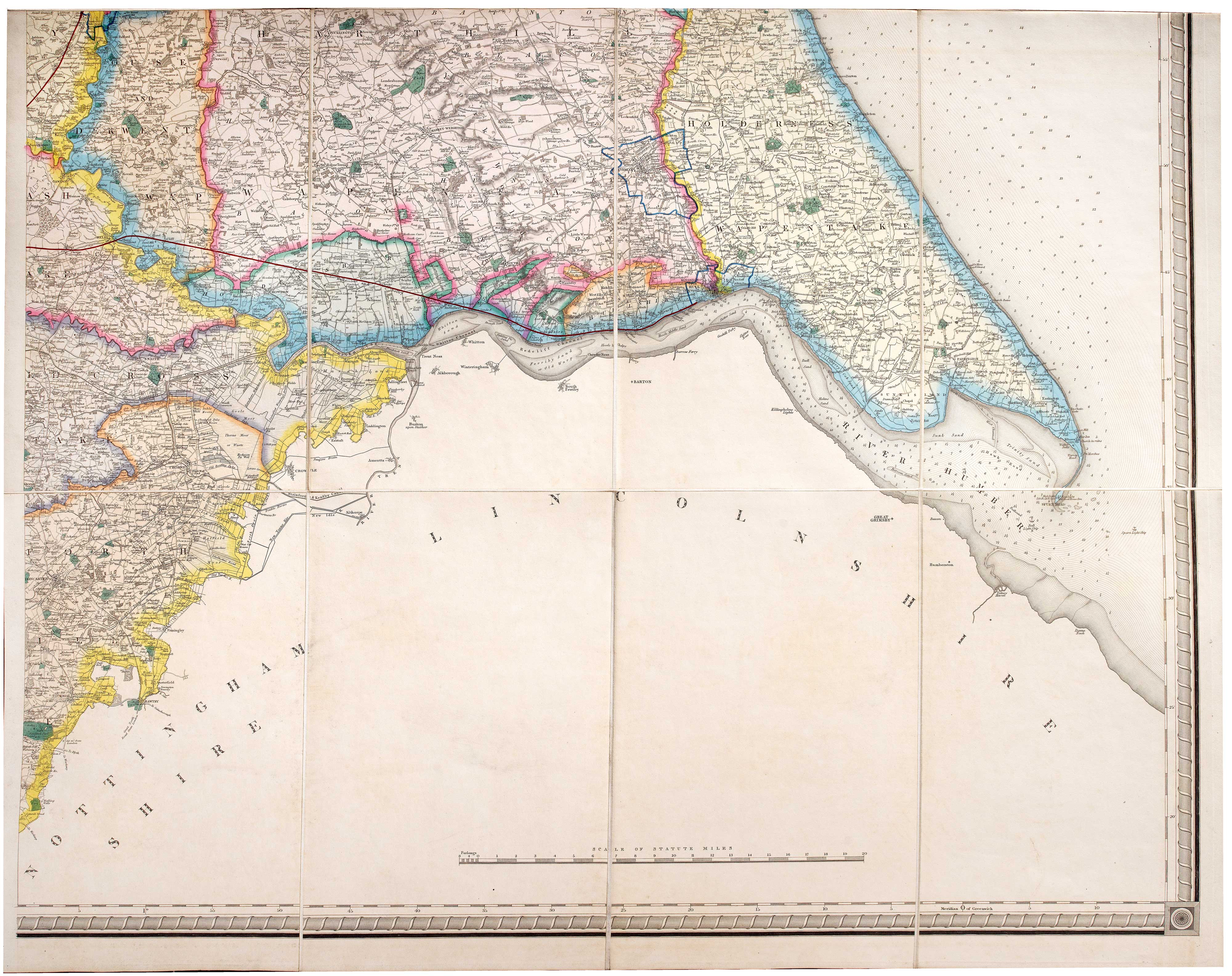
A large and detailed map of Yorkshire
HOBSON, William Colling.
This Map of Yorkshire, is most respectfully dedicated to the Nobility, Clergy, Gentry, Landownsers, and Manufacturers of the County, By the Proprietor, William Colling Hobson, 1843.
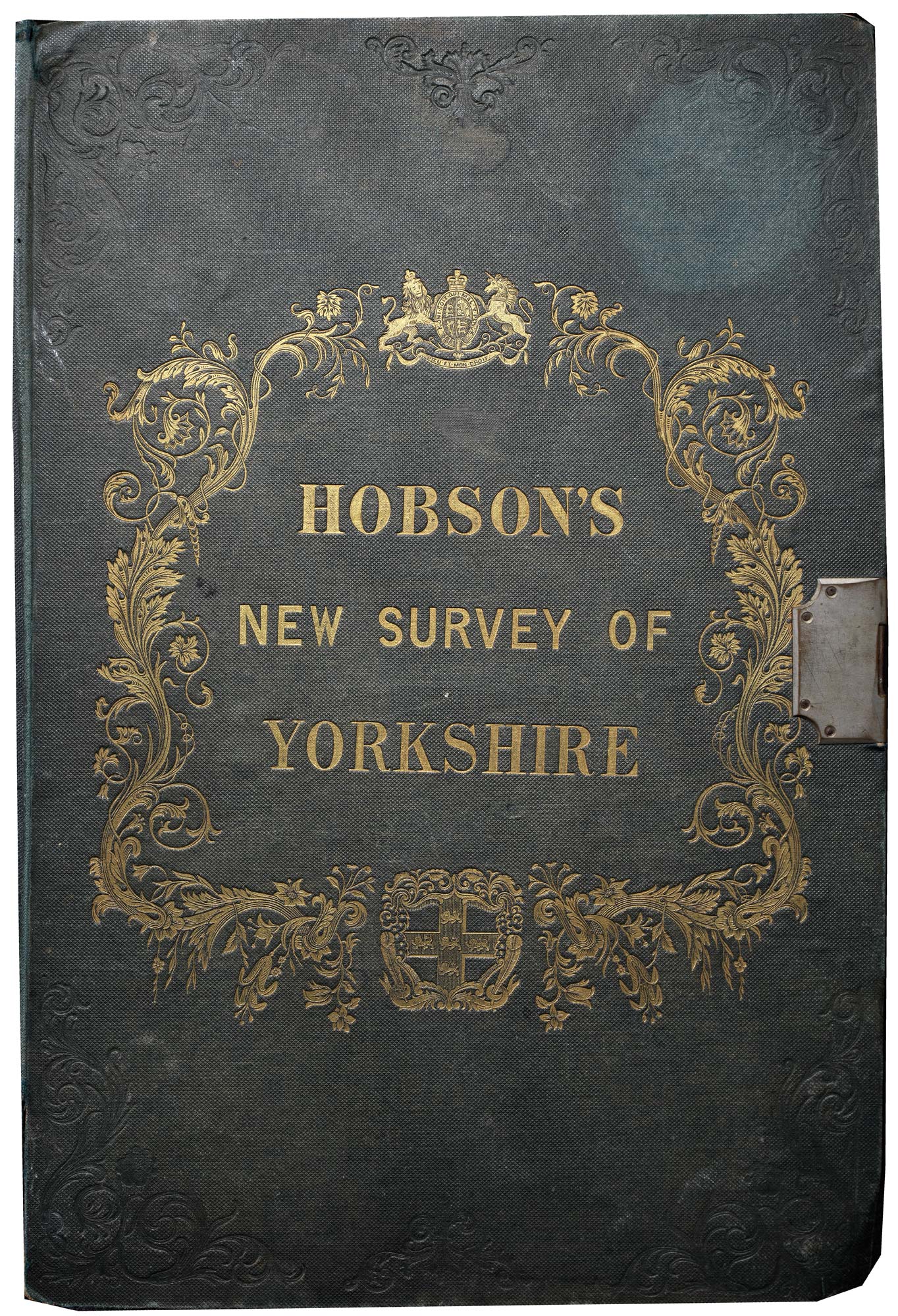
London: Hobson, 1843. Steel engraved map on four sheets, in fine original colour, dissected and laid on linen in two panels, each 1280 x 810mm (total if joined 1280 x 1620), folded into original green cloth gilt covers with original pewter clasp.
Covers a little worn
A large-scale map of Yorkshire in full colour, with an impressive amount of detail, including roads, railways, water mills and windmills, and the borders of Ridings, Wapentakes, the Honour of Pontefract, the Manor of Wakefield, Boroughs and Poor Law Unions.
Stock ID : 23850
£550
£550

A large and detailed map of Yorkshire
HOBSON, William Colling.
This Map of Yorkshire, is most respectfully dedicated to the Nobility, Clergy, Gentry, Landownsers, and Manufacturers of the County, By the Proprietor, William Colling Hobson, 1843.
London: Hobson, 1843. Steel engraved map on four sheets, in fine original colour, dissected and laid on linen in two panels, each 1280 x 810mm (total if joined 1280 x 1620), folded into original green cloth gilt covers with original pewter clasp.
Covers a little worn
A large-scale map of Yorkshire in full colour, with an impressive amount of detail, including roads, railways, water mills and windmills, and the borders of Ridings, Wapentakes, the Honour of Pontefract, the Manor of Wakefield, Boroughs and Poor Law Unions.
Stock ID : 23850
£550
£550


Altea Antique Maps & Charts
Altea Gallery Ltd, 35 St George Street
London
W1S 2FN
United Kingdom
Tel: +44 20 7491 0010
info@alteagallery.com
Sitemap :

